Getting Our History On At Fort L’Ecluse

On our first hike in the  Jura Mountains went through the Rhône Valley by Fort l’Écluse (or Fort de l’Écluse), near Leaz, France in the Pays de Gex.  The site has a view of the strategic route between the Jura Mountains and the Alps and has had fortifications since Roman times.

The Romans built defenses around 58 BC to protect them from the Helvetii (the nearby Swiss tribe). In the Middle Ages, the stronghold protected the Jura and was a center for goods (which the cyicist in me interprets to mean used to collect tolls or taxes).  Expanded, in the 17th century, the French used the fort to prevent French Protestants from fleeing France to Protestant Geneva after the revocation of the Edict of Nantes (which permitted secularism and tolerance).

There are actually two forts on the site, the lower (inférieure in French) and upper (supérieure in French).  The Duke of Savoy and the Marquis de Vauban (during the reign of Louis XIV) built the lower fort.  When the Austrians destroyed the fort in 1815, the Savoy rebuilt it bigger and stronger.

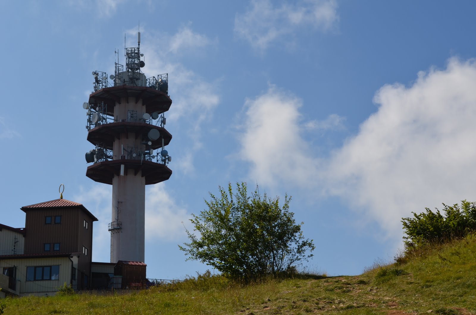
The tower dovetails into the rock.

We got lucky, they were having a historical reenactment when we visited.  It got us admission and we saw solders living as they did in the 19th century.  Some of them were cooking.  I asked what they were making.  The “soldiers” jokingly said “nothing good.” They explained that soldier’s food wasn’t good and they were being historically accurate.  We spied a couple of bottles of wine tucked away behind some plants (also historically accurate?), so I think they had a good time anyway.

Built into the stone, the fort was surprisingly cool (which was good for them in their wool uniforms).  The reenactors were really nice and totally into it.  When I asked to take a picture with them they gladly agreed and, to my astonishment, passed me the musket.  It weighed 5 kilos (10.2 pounds)!

The upper fort (200 metres/660 feet above the lower one), was built in the 1830’s-40’s to protect the lower fort provide additional space and better views from which to control the valley.  It has a subterranean stairway with 1165 steps through the rock that connecting it to the lower fort.

Unfortunately, the upper fort is closed because it is unsafe for visitors.  They are doing restoration work on the lower fort.  We hope that when they finish, they start on the upper fort because it is an amazing site and filled with history.

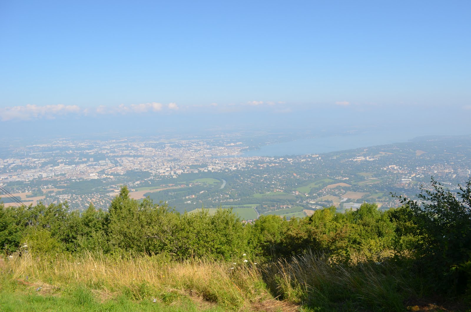
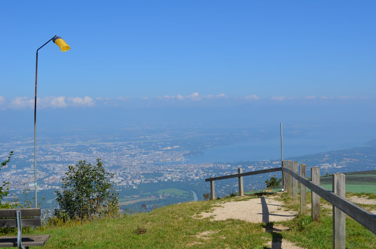
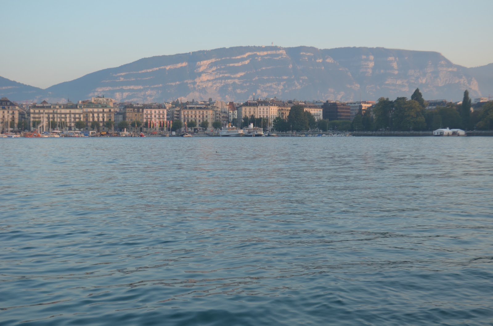
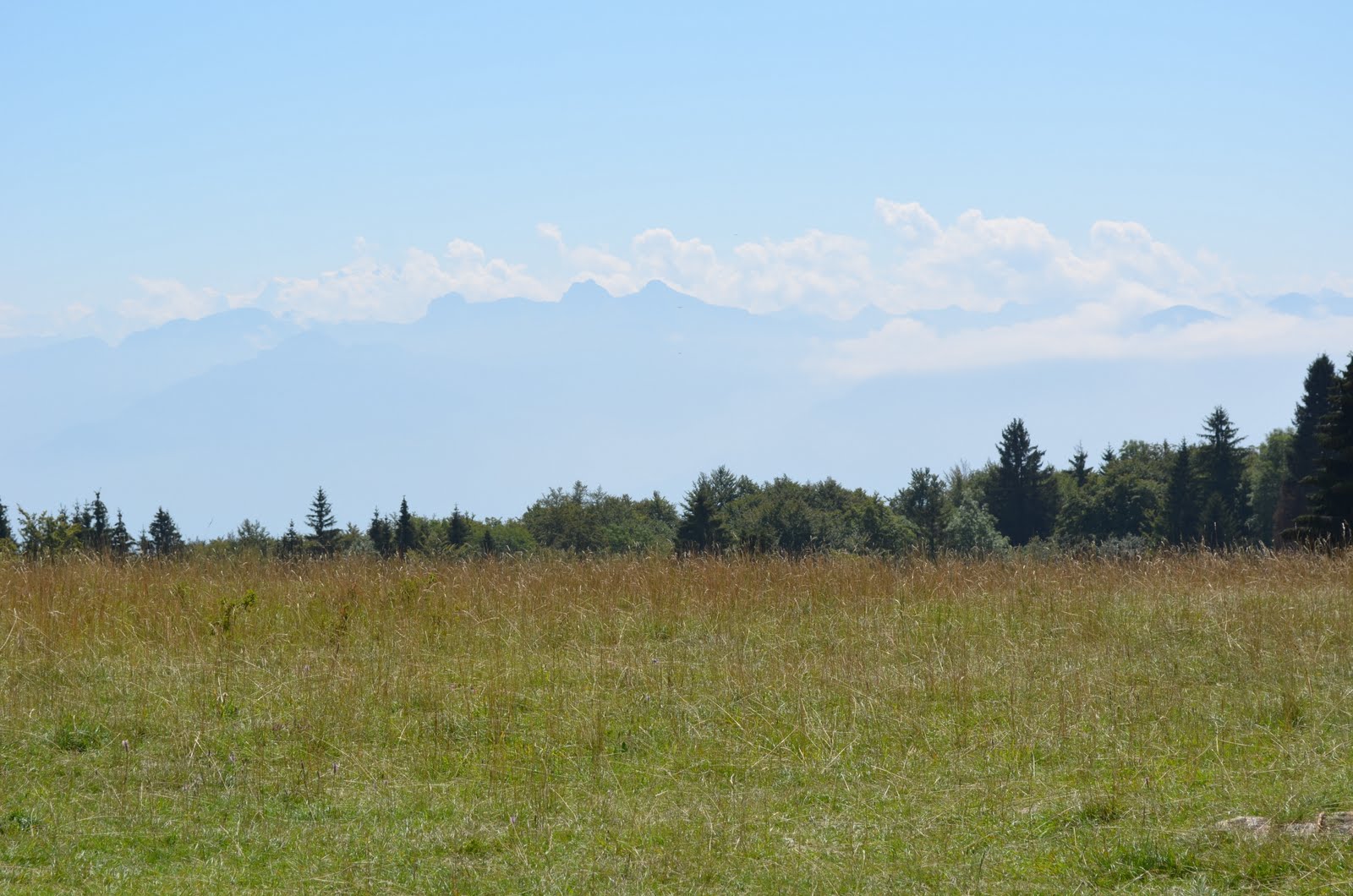
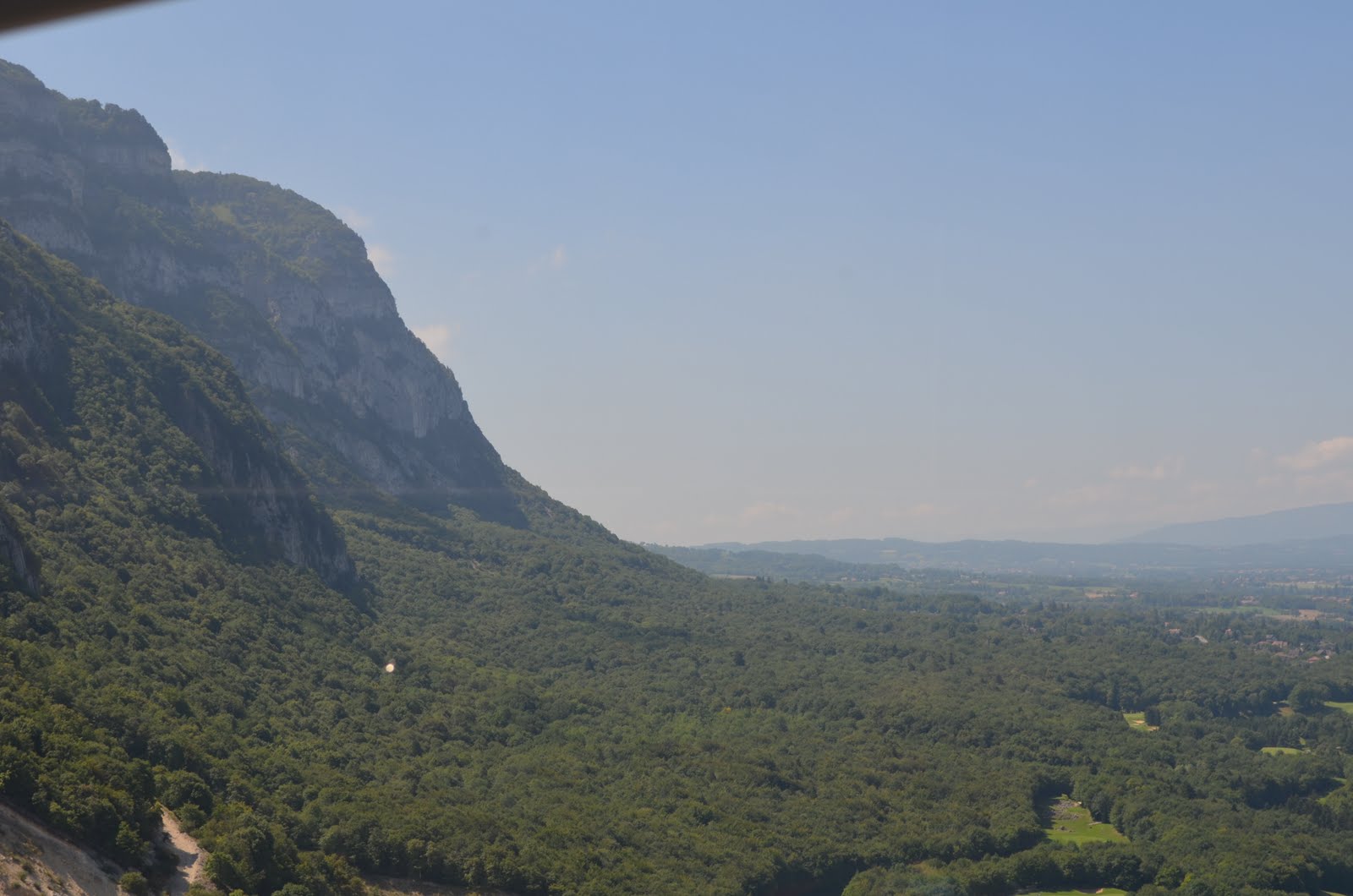
We took a steep trail uphill for a half an hour to reach the upper fort.  I shouldn’t have bothered to ask the extremely portly gentleman we encountered in the lower parking lot for directions.  I’m pretty sure he hadn’t done much walking, let alone hiking, over the past 30 years.  The gentleman said the upper fort was closed, there was no reason to go up there and looked at me like I was crazy when I told him we were hiking.   We are glad we went anyway.  We were still able to see the ramparts.  Even better, they had exceptional views of  the Rhône, Saleve and the Alps, including Mont Blanc.

Fort l’Ecluse wasn’t just a customs station and border control in the 20th century.  It served as a military training center during World War I.   In the 1930’s, the fort was incorporated into French border fortifications (as part of the enormously inefficient Mangiot Line) that were intended to prevent a German invasion from Switzerland.  We all know how that worked out.

I was astounded to learn that it actually saw action during WWII.  It is so close to Geneva, I can only imagine the anxiety that Genevans must have felt.  The Defensive Sector of the Rhône, a French military organization controlled the French border with Switzerland around Geneva, controlled the fort.  In June 1940, German forces (the 3rd and 4th Panzer Divisions and the 13th Motorized Infantry Division) advanced from the north along the Rhône valley.  From June 22nd to 25th, the French force held the back the German forces advancing toward Albertville.   When France surrendered on June 25, the fort didn’t.  It held tight until directly ordered to let the Germans advance and surrender by General Charles Huntziger of the Vichy Regime.

Our First Big Hike Of The Summer

Our first Sunday back in Switzerland, the weather was supposed to be great and we were keen to hike.  He traveled last week so he wanted to sleep in.  This meant that we needed to go someplace near Geneva.  We hadn’t hiked the Jura yet and decided to give it a go.

The first weekend after we moved to Switzerland we explored the area.  Driving back from Annecy and The Museum of the Alpine Cow, we saw a giant fortress in the mountain above.  We wanted to visit it and a hike seemed like the perfect opportunity.

We were on the last mound by the river. It has a small, dark smudge on top. Those are the ruins with a statute of the Virgin Mary on top.

We started from Léaz, France (just over the border) and hiked up to the Virgin of Léaz and stunning views of the Rhone River cutting its way through the Jura Mountains.   The Virgin sits on top of sixteenth century ruins, but the spot was inhabited in Roman times (because of its defensible position.  The views were stunning, but I was careful to watch where I stepped.

We walked all the way down to the Rhone River.  Although it was a hot day, we didn’t stop for a swim (we’ll go bridge jumping into the Rhone at Junction soon enough).   The banks were muddy and we had hiking to do… a lot of it.  Uphill.

What goes up, must come down.  We went down to the Rhone, so there was nowhere left to go but up.   On the bright side, the terrain was interesting, varied and shaded (not many panoramic views).  We passed countless streams, waterfalls and channels that funneled water from the Jura into the Rhone.   The trails were okay, but I wouldn’t plan on doing the hike if it rained the previous week and the trails climb sharply.  You were warned.

We hiked up to Fort de L’Ecluse (both of them) through The Haut-Jura Regional Natural Park and down from the mountains.  As the mountains gave way to pastures and fields, we heard our first cowbells of the season.  We love the sound of cow bells ringing through a valley interrupting the background noise of gurgling creeks and chirping birds.  It is the soundtrack to a heavenly day.

One of the best parts of the hike was the wildflowers in bloom.  I snapped way too many pictures of them.

The fields were pretty gorgeous too.

So was the view.  Let summer officially begin!

Geneva’s Bucolic Beauty

Why drive to visit a brewery when you can hike there?  We had visitors who were up for a little physical activity so we set off.  We arrived at the Brasserie des Murailles after they had closed, but had a wonderful hike.  You may notice that isn’t us.  We had Mr. Rome and Ms. Barcelona with us.  Although we’d never met them before picking them up at the train station, we (and all our friends) loved having them around.

We set off from the center of Geneva.  The lakefront was beautiful.  Once you turn away from the Lake Geneva, there is nowhere to go but up…literally.  Whether on bike or on foot, anywhere you head from Geneva’s lakefront, you climb.  It’s unavoidable.  The good news is that it doesn’t last forever.  Soon, we were higher, cooler and out of the city.

Switzerland is committed to remaining neutral.  Only 1/3 of its land is cultivable.  As a result, farms are subsidized and farmers act as stewards of the land.  It also means that it is almost impossible to build on farmland in Switzerland, limiting urban sprawl.  It doesn’t take long to get out of the city and into farmland.

Geneva’s mountains are astoundingly beautiful.  It’s countryside is pretty all right too.

Although it isn’t as dramatic as the mountain scenery, there is always something interesting to see.  We paused over vineyards, horses, beekeepers, to check out frogs in streams, to examine crops and check out the colza fields.

We loved that behind the fields and vineyards, the mountains were almost always visible.  Depending on the direction, they were either the Alps with Mont Blanc, the Jura or Le Salève.   Not too shabby.


Neuchâtel, As Cute As Any French Town…But Swiss

Last weekend, we stopped for a peak at Neuchâtel.  I’d heard it was cute, so we had to check it out.  From the French influenced architecture to the cafes that spill out onto squares, it looks and feels more French than the rest of Switzerland.

People have lived there since about 13,000 B.C., but a castle was built on the site in 1011.  From the name Neuchâtel, it’s assumed that it replaced an older one on the site (In French, Neuf = New and Chateau = Castle).  A town soon followed.  Needless to say, it’s been around long enough to develop some cool, quirky features.

The Seyon River  used to flow through the town (where Rue Seyon is now located).  It’s flooding was devastating and a tunnel was built diverting the river a few blocs.   To mark where the river once flowed, there is a little water feature running through the street.

Footbridge across castle moat.  Pretty sweet.  The best part is that it connects to a park.  How much would you like to play capture the fort here?

Empress Josephine slept here.

The Swiss officials drained millions of cubic feet from Lake Neuchâtel, in 1870, lowering the lake level by 10 feet.  As a result, formerly lakeside chateaus  and their stone banks now sit inland.  A good amount of Neuchatel’s lakeside is now lined with elegant promenades.  The Promenade Noir was urban infill on the new lakefront property.  The buildings on one side of the street date from the 1600’s and the other side date from the 1800’s.  The building above is across the street from the building below!

Nice looking post office on new lakefront property.

Many of Neuchâtel’s older buildings are made from the local, yellow sandstone.  It’s an amazing, rich, color.

It’s even got its own cheese.  I prefer Neuchâtel to Philadelphia Cream Cheese on a bagel.  It healthier too.  Heck, it may even be healthier than Philly light.  You can blow the calories you saved on some Swiss chocolate.

Although the lakeside had a pretty view of the Alps and Jura, we like the views from our lake (Lac Leman/Lake Geneva) better.  The views get better as you get higher.  Some of the surrounding areas have stunning views.  Sorry I couldn’t get any decent ones from the car window.

Neuchâtel watchmakers made delightful little mechanical figurines that are displayed in the Musée d’Art.  We visited on a holiday morning so it was closed.  We hear it’s worth a peek if you get the chance to visit though.


What You Can Learn From License Plates In Switzerland

In Switzerland, license plates are assigned based on experience, thus low number plates usually indicate someone who has been driving a long time (i.e., an old person). Larger cantons (GE, ZH, etc.) have more cars and so the numbers on the plates extend much higher.

Very low numbers (e.g., “GE 3”) usually are assigned to taxis. On government cars have a single letter (instead of the canton): “A” for administration, “M” for military. There are no personalized license plates.

Diplomatic plates are all over Geneva.  They have CD in a blue square on the left of the plate.

Each canton (like a state) has its own abbreviation.  When you are in the parking lot of a ski resort, you are easily able to tell where the other skiers live in Switzerland.  I find looking at them is helpful in learning the coat of arms for each canton.

The abbreviations for the cantons (listed in German, French Italian and English) are:

Often, you see EU (European Union) plates in Geneva.  It’s understandable given our proximity to France.  Sometimes, you even see foreign plates.

I once saw US plates while I was riding on the bus.  Sorry, I couldn’t get a photo.


Snowshoeing, It’s Like Hiking But More Awkward.

Last weekend, we went snowshoeing.  The snow here is melting…quickly.   We knew that we wouldn’t have too many more opportunities.  If you need confirmation that the season is over, just take a look at the snow above.

St. Cergue is in the Jura the lake, where there’s only a thin white band of snow at the top.

We strapped up our hiking boots, went to St. Cergue and rented snowshoes, having no idea what we were getting ourselves into.  Thankfully, some nice Swiss snowshoers helped us make sure they were on correctly.  They let us try their poles.  Not knowing much of anything about snowshoeing, we didn’t rent poles.  Ooops.  It was definitely easier with the poles, but we only went about four miles so we were fine without them.  The lack of snow near the parking lot was more problematic.

Luckily, this was the only area where the snow was sparse.

We encountered a few other Swiss on the trails and learned that the usually reserved Swiss are pleasantly chatty on the trails.  In Geneva, expats don’t always get the opportunity to have meaningful interactions and conversations with native Swiss.   We learned a lot about the area from them.  For example, these stone walls mark the borders of farms.  They aren’t relics.  In the Jura, they still build them!

When we weren’t chatting with other snowshoers, we enjoyed the peace and tranquility.  It was a gorgeous day.   It was a pleasure to be out in the woods and going “off piste” through the snow was a blast.

In this area summer farmhouses become winter restaurants that cater to the area’s snowshoers and cross-country skiers.  We got a recommendation from a nice Swiss lady on the trails and she did not steer us wrong.  The restaurant, Le Vermeilley, was fantastic.

It was a cozy room with wonderful traditional dishes and a nice proprietor.  After a nice lunch, we headed back.

We’d expected snowshoeing to be more difficult than it was.  I want to try it again  next year.   He wants to do some cross-country skiing more.   We have friends who snoeshoed at night under a full moon.  That sounds like a rocking’ good time so I’m pretty sure I can talk him into it.

Some trails around there are only for cross-country skiers, no snowshoers. I guess we’ll have to try that next year.


La Saleve

When we first arrived, we took the cable car up to one of the mountains overlooking Geneva, La Saleve.  It is known as the  “Balcony of Geneva” even though it is technically just over the border in the Haute-Savoie region of France.  From there, you can see the Jura mountains, the PrealpsLake Annecy and the Mont Blanc.  Even on cloudy days, the top of Saleve can be sunny!

It wasn’t until later that we learned people will hike and even bike up it.  It also has a nice view of the city and decent trails. Once up there, there are many outdoor activities to take part in, rock climbinghikingmountain bikingparagliding (who jump off the carpeted area in the photo below), hang glidingmodel aircraftspeleology and skiing (at the Col de la Croisette).  We looked out at Geneva and found where we live.  I would love to camp up there and watch the sunset and sunrise over the city. Shedrub Choekhor Ling Tibetan Buddhism center is located on the Salève.  They have a normal building, but it was their yurt that attracted our attention.  Their building is only 200m from the Cable car station. This authentic Tibetan Temple was consecrated and opened by the Dali Lama in September 2011.   I read an article about a Russian arms dealer has property next door to the Buddhists.   The irony. The tower is visible from the city of Geneva.

Mary Shelley‘s Frankenstein  was written on the banks of Lake Geneva (Lac Leman).  In it title character climbs up the Salève  after fleeing.  Salève is mentioned several times by name.  

  • “It was echoed from Saleve, the Juras, and the Alps of Savoy…”
  • “I thought of pursuing the devil; but it would have been in vain, for another flash discovered him to me hanging among the rocks of the nearly perpendicular ascent of Mont. Saleve, a hill that bounds Plainpalais on the south.”
  • “Who could arrest a creature capable of scaling the overhanging sides of Mont Saleve?”

Saleve itself isn’t in the alps, but what is known as the French Prealps.  Note the Alps in the background of the above photo.  The ride down in the cable car was our first cable car experience since moving to Geneva.  At the time, we had white knuckles, now, we’re old pros.   Another view of Saleve from the city.