Stockholm’s Archipelago

DSC_0205

Archipelago – ar·chi·pel·a·go. noun \ˌär-kə-ˈpe-lə-ˌgō,

  1. An expanse of water with many scattered islands
  2. group of islands

DSC_0341

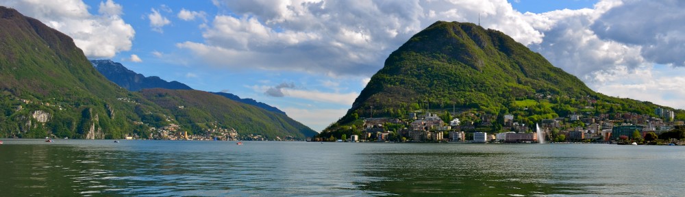
There aren’t that many true archipelagos; Stockholm’s archipelago is the real deal.  It has more than 30,000 islands!  I guess it’s not all the surprising.  Stockholm itself is made up of 14 islands that are connected by 50 bridges on Lake Mälaren and the Baltic Sea.  It’s definitely a maritime city.  When we visited in March, I took a boat tour of the area, but it was too cold to really enjoy the outer islands in the Baltic.

DSC_0364

For Stockholm’s residents, the archipelago is a easy escape and their holiday retreat.  There’s an island for everyone.  Partiers, those looking for peace and quiet, sunbathers, woodsy hikers, campers, B&Bers, luxury hotel lovers…there’s an island for everyone. The archipelago is easily accessible via ferry.  There are two main ferry companies.  One with larger, faster boats (Cinderella Båtarna), the other (Waxholmsbolaget) with charming smaller boats that make it feel less like a commute and more like a pleasure cruise.

DSC_0997

We took the Waxholmsbolaget boat to Vaxholm.  The journey was half the fun.  The boats are adorable with wood interiors and brass details.  It’s the perfect place for a picnic.  We sat outside and watched the hustle and bustle recede.  I was worried about not hearing our stop.  The boat docks, people disembark and it pulls away with remarkable speed.  I shouldn’t have been, locals (who all speak great English) volunteered to let us know when we got close.

DSC_0382

The Cinderella boat back was larger and a bit faster, but didn’t have quite the charm.  My advice, take either one.  You can’t go wrong.

DSC_0299

Stockholm’s archipelago is a UNESCO World Heritage site.  It consists of 20,000-50,000 islands off the coast of Sweden that offer a buffer to the Baltic Sea.  “Skärgården,” as the area is known to the Swedes, was formed by glaciers that carved out and deposited granite that protrudes from the water.  As a result, it is full of reefs and shallows The islands get progressively less rocky, sandier and smaller with fewer trees the further you get from Stockholm.

DSC_0410

Vaxholm  is an idyllic archipelago town with well-preserved wooden villas from the turn of the 19th century.  Everything about it says cottage cute. It has nice restaurants (especially if you like fresh fish), a wonderful bakery, charming cafés, and way cooler shopping than your average resort town.  I wanted to decorate with and wear things from just about every shop.

DSC_0234DSC_0247DSC_0232Although you can rent bikes, we spent an afternoon doing a big walking tour of the area.  There are plenty of trails, sidewalks and quiet streets.  We tried to get away from the business district to get a look at how people live there.  Even without the cute shops, restaurants and hotels, it was very picturesque.  I loved the brightly colored houses and cute gardens.  We saw backyard meals, people walking their dogs, mowing their lawns and cleaning out their garages.

DSC_0249

The have a decent sized marina and with the essential nearby farm stand and ice-cream stand.  Across the narrow strait is the historic Vaxholm Fortress.  From the shore, you can see several small islands with adorable but solitary houses and a dock.  Vauxholm is the last easily accessible place in the archipelago by car from Stockholm and is even accessible by bus.  In fact, it is the most populated archipelago town and people live there year-round.  Tiger Wood’s ex-wife Elin Nordegren grew up there.  Don’t worry through, there’s no hustle and bustle, it’s perfectly tranquil.

DSC_0271

Do You Also Giggle When You Say Flying Buttresses?

DSC_0516_2Every time I say “flying buttress” he laughs.  For some people, Notre Dame is a religious experience.  Our promenade around the exterior was more like a giggly experience.  Each time someone said “buttress,”  it was pronounced “BUTT-ress.”  You can’t take us anywhere.  Nevertheless, I still think flying buttresses are cool and good for more than just a laugh.

DSC_0578_2

Gothic churches are tall, spacious and filled with light.  Why?  The magic of technology.  Buttresses support the walls outward force.  Pointed arches (instead of the round Romanesque arches) allowed the enormous weight of stone roofs transferring it out and not just to the walls.  Essentially, the buttresses support the weight of the roof. This made building thinner walls with windows possible.

DSC_1074

You can see the support inside with a network of columns that become pointed.  They intersect at the top of the roof.

DSC_0069_3

Nowhere can you see this more than in Paris’ Sainte-Chapelle.  Almost all the walls are windows and it is filled with light.

DSC_0566_2

St. Emilion, Where They Make The Nectar Of The Gods


I don’t want to bore you with stories of another medieval hill town or tales of wine, but on our ladies road trip, we fell in love with Saint-Emilion and I can’t help but wax rhapsodic about it.  It is a gorgeous medieval hill town made of limestone quarried locally.

Around 5,400 hectares of vineyards and many small châteaux surround it.   Saint-Emilion has all the accoutrements you expect in a cute french hill town, inviting squares, cute shops, cobblestones, music wafting through the air, flowers, fountains, light blue shutters that look great against the limestone…you get the idea.  If I haven’t already convinced you to endure one more hill town post, that it is a UNESCO World Heritage Site probably won’t sway you either.

Saint-Emilion  has been located on the pilgrimage route to Santiago de Compostela since the 11th century.  As a result, many churches, monasteries and hospices were built there.  We’d heard that the bell tower of the St. Emilion Monolithic Church had the best view of the city and it was worth making the climb up the ancient winding stairs to the top of the tower.  We paid a Euro or two each and grabbed the key from the Office of  Tourism across the way.

The bell tower was built between the 12th and 15th centuries.  Not long after that, people started carving their names and dates into it.  I’m a sucker for ancient graffiti.  I loved searching for it and reading it. The best part though was the view. Heaven.

Unfortunately our, ahem, transportation challenges (broken clutch) prevented us from having more time to tour Saint-Emilion.  I’d hoped to see the vast limestone catacombs located under the city that contain Europe’s largest underground church.  They are supposed to be amazing.

Fortunately, we still had time to check out the romanesque church and cloister, shop for antiques (you know I couldn’t pass up an opportunity to poke around this cute store), have a nice meal, listen to some street musicians, stroll the streets and catch one heck of a sunset.  Not too shabby.


Our Balade In Bellinzona


Bellinzona would be epic (and possibly ruined) if it were located on a lake.  Instead, it is strategically located at the confluence mountain passes and near others (NufenenSt. GotthardLukmanierSan Bernardino and the Poebene).  At one time, it was the capital of the region.

Bellinzona’s Old Town is graceful and enchanting.  It has beautiful, ornate merchants’ houses, stone gateways, wrought iron balconies and peaceful courtyards.  It is car free.  If you ignore the other tourists strolling the alleyways, it is easy to transport yourself to a bygone era.

It’s not glitzy, but its richly decorated patrician houses, beautiful churches and charming streets are relaxing and seductive.  You can literally feel your blood pressure drop.  Walking the streets, you want to stop, enjoy the atmosphere and take in all the colorful details.

This peacefulness is ironic.  Bellinzona doesn’t derive its name from its beauty (Belle or Bella), but from “zone bellica” which translates into “war zone.”   The main evidence of the city’s turbulent past are its castles and fortifications which are just outside the old town.


We Rocked The Boat – The Second Part Of Our Trip Up The Rhine 2

Castle Pfalz (Die Pfalz or Pfalzgrafenstein) sits on the island of Falkenau in the middle of the Rhine.  Not surprisingly, it was a toll castle built for the sole purpose of generating revenue.  The Baron would raise and lower chains across the river controlling traffic.  It worked in concert with Gutenfels Castle (Burg Gutenfels) and the fortified town of Kaub on the other side of the river.  They kept those who refused to pay in the dungeon, a wooden float in the well, until they were paid.

Apparently it has an impressive view from which you can watch ships travel on both sides (take the ferry from Kaub).  As it was never conquered, destroyed, it is in good shape even though it doesn’t have electricity or a privy.  The little extension was the outhouse; it uses gravity and rainwater.

Kaub is known as the spot where Field Marshal Gebhard Leberecht von Blücher  crossed the Rhine with the Prussian and Russian armies, on New Years eve 1813-1814, in pursuit of Napoleon.  During the war against the French, Blücher moved 50,000 troops across a Russian-built pontoon bridge. It was an extraordinary achievement.  It was also an important step toward the final defeat of Napoleon…well, until Waterloo.

Oberwesel is a pictoresque town.  He thought that it’s church, the  Gothic Church of Our Lady (Pfarrkirche Liebfrauen), looked like a larger version of the church built by German immigrants in his hometown.  The Günderrode House is famous in Germany because it featured in TV Series “Heimat.”

Schönburg, also known as Schloss Schönburg (beautiful fortress in German), is another impressive castle.

The Loreley Bend, before modern navigation systems many ships sank here.  Immediately around the bend sits Loreley Rock, a infamous, steep rock 132 meters high.  Legend has it that a pretty, naked blond woman sat on the rock singing and brushing her hair.  She distracted the boatmen from their work and caused ships to crash (described in a well-known folk song).  Today, a statue of a woman sits on top of the rock.

If you look hard, you can see the statue in front of the red train car.

A likelier explanation for the large number of accidents is the narrowness of the riverbed and many rocks around a sharp curve in the river. Even with modern navigation systems, that section of the remains dangerous.   When the water level is low, treacherous reefs appear here (if you believe the fable, they are seven hard-hearted virgins who were turned into rocks).

When we told some Germans where we were headed, they said “oh, the dangerous section.”  Just last year a ship transporting sulfhuric acid overturned there.  Luckily they were able to right it and get it under control before it leaked.  Unfortunately, two crew members were swept overboard and drowned.

Founded in the 6th century, the village of St. Goar is the former capital of the area and the most heavily fortified town on the Rhine.  It is a vibrant town in a picturesque setting, which isn’t surprising given their economies are based on tourism and wine.

In Rheinfels Castle’s heyday, it was the most powerful fortress in the area.   The Baron who built it arbitrarily increased the duties and 27 towns formed an alliance (with 1000 knights and 50 ships) to stop him.  The fortress withstood the siege and they gave up after about 16 months.

The scene of numerous bloody sieges, it has a storied history filled with violent changes of ownership. Napoleon took unchallenged control of the castle in 1796 and promptly blew a good chunk of it up.   Today, it’s only a fraction of its original size.  It’s still one of the coolest of the Rhine castles to tour.

Burg Katz, across the river from St. Goar above the town of St. Goarshausen, was bombarded in 1806 by Napoleon and rebuilt in the late 19th century.  Don’t think about hiking up there.  Some rich guy (or gal) owns it and it’s not open to the public.

We Rocked The Boat – Our Boat Trip Up The Rhine

One of the Rhine’s most renowned sections is the Rhine Gorge in Germany (aka the Middle Rhine, Rhine Valley and Romantic Rhine). Technically, this area starts in Mainz and ends in Koblenz (that area is the stretch of the river designated a UNESCO World Heritage Site).   A boat trip down the Rhine is an excellent way to see the area’s magnificent landscape, towns, vineyards, castles and fortresses.   We’d heard that the stretch between Bingen and St. Goar (which is a UNESCO World Heritage Site) was particularly beautiful.   It was.

It’s UNESCO World Heritage Site means that there are no bridges.

Castles + vineyards + valley = storybook cute   There are at least 30 castles in the 66 kilometer (41 mile) stretch from Rudesheim to Koblenz.   Why are there so many castles there?

The Rhine has been a major transport route since Roman times.  Where there is money, there are those that want a piece of it.  River barons built the castles to impose tolls on the river traffic by controlling their stretch of the river.  If boat captains didn’t pay the toll, they would be treated to “complimentary room and board” in a dungeon until they paid.

From the dock at Bingen, we could see something that looked like the Statue of Liberty.  We weren’t far off; it was Rüdesheim’s Niederwalddenkmal.  Built by Kaiser Wilhelm I from 1881-3, it commemorates the founding of the German Empire after the end of Franco-Prussian War.  Essentially, it sits near the French border and serves as a warning to France that they will get another whooping if they try to invade again (or at least that’s how it was explained to us).

The toll tower “Mäuseturm,” known as the Mouse Tower, was the first sight we saw from the boat.  The name comes from a legend in which the tower belonged to a cruel ruler who oppressed and exploited the local peasants. in his domain. During a famine, he refused to distribute any of the tower’s grain supplies to the starving peasants.   When they threatened to rebel, the ruler tricked them, telling them to wait in an empty barn for him to come with food. He ordered the doors barricaded and set fire to the barn, commenting “hear the mice squeak” (referring to their cries).  Returning to his castle, an army of mice began to swarm him.  He fled to the tower, they followed and ate him alive.  Yikes!

We barely had time to listen to the story before seeing our first ruin, the ruin of Ehrenfels Castle (Burgruine Ehrenfels).  The rapid succession continued for the rest of the trip.  Wow!  We were amazed.

Built in the early 1300’s on a strategic hilltop, is Burg Rheinstein.  Prince Frederick of Prussia bought the castle and rebuilt the castle in the 19th century.  Nearby the impressive medieval Burg Reichenstein is a now a modern hotel.

Burg Sooneck, also known as Saneck, Sonneck and Schloss Sonneck (click on the link to find out its relationship to Swiss history and the Battle of Sempach), was an infamous haunt of the river’s robber barons. The Crown Prince of Prussia, Frederick William IV, and his brothers Princes William, Charles, and Albert bought the completely derelict castle and rebuilt it as a hunting castle.

The tiny town of Niederheimbach has the 13th century Heimburg Castle and the little church called St. Mariae Himmelfahrt.

Lorch is a small town that has a lot for its size.  You can easily spot it’s church, Pfarrkirche St. Martin (Saint Martin’s Parish Church), from the water.  In the 18th century, the witch’s tower served as a sort of jail for wrongdoers and “witches”.  The Nollig ruins (Ruine Nollig on the Rheinsteig trail), overlook the town and are the remains of the old town fortifications on the rugged ridge.

Bachrach is over 1,000 years old, and I thought we were getting a little long in the tooth.  Just like the house of an octogenarian, it accumulated bits and bobs over time (the walkable city walls, 16 watchtowers, the picturesque “Malerwinkel”, the ruins of St. Werner’s Chapel).  Stahleck Castle (Burg Stahleck), one of the most photogenic castles, sits on a hill above.  It was destroyed by the French in 1689 and is now a youth hostel.  I’ve stuck him in some cheap hostels before, but never a nice one like this.

Bellinzona’s Strategic Location

Bellinzona has been a fortress since Roman times due to its strategic location.  It is located on the valley floor at the base of the great alpine passes of the St. Gotthard, San Bernardino and Lucomagno (Lukmanier).

Romans built fortifications on the spot where Castelgrande now sits.   The nearby town of Bellinzona is named not for the Italian bella (“beautiful”), but for the Latin bellum (“war”), and this truly was a medieval war zone. Several castles in Bellinzona recall a pivotal Swiss victory in 1513. With this success, the Swiss gained a toehold in Ticino.

The Duke of Milan (the Visconti family) purchased Bellinzona in 1242.  They built a new castle atop the town.  Later, their allies, the Rusconi family of Como, built Montebello up the hill.

The Swiss, invigorated by their victory over the Hapsburgs at the Battle of Sempach and wanting to protect their newly won independence decided that possessing strategic Bellinzona on the other side of the Alps would reinforce their defenses.  They began their campaign in the 1420’s.  In response, Milan’s current rulers, the powerful Sforza family, reinforced the castles and built Sasso Corbaro even further up the hill.  They also built a massive chain of fortifications that extended across the valley.

It took the Swiss about 100 years, but they won.  In 1516, Bellinzona became part of the Swiss Federation.  The Swiss did their best to ensure that they kept it.   For the next 300 years, Swiss overlords oppressed and controlled the local population.

The three castles (Castelgrande, Castello di Montebello and Castello di Sasso Corbaro) and their accompanying fortifications are a UNESCO World Heritage Site.

We Had Fun Storming Bellinzona’s Castles

From Lugano, we took a day trip to Bellinzona.  Bellinzona’s three medieval castles (Castelgrande, Castello di Montebello and Castello di Sasso Corbaro) and their fortifications are among the most important examples of medieval defensive architecture in the Alps. These fortifications are also a UNESCO World Heritage Site.

Living in Switzerland, we have castle fatigue.  Poor us.  We happily forego an opportunity to see castles if they aren’t great.  My buddy Rick Steves’ has a list of Europe’s 10 best castles.  I’ve been lucky enough to see a fair number of them and some others, like Windsor Castle, that didn’t make his list.  You can’t swing a dead cat in Switzerland without hitting a castle or the ruins of one (sometimes they’re cooler than the ones still standing).   As a UNESCO World Heritage site, Bellinzona’s castles were supposed to be pretty good and they were definitely worth the trip.

Castelgrande is Bellinzona’s oldest and largest castle.  It overlooks the Old Town. They have built an ingenious elevator/stair system that allows to visitors access the castle from the rock underneath, from inside.  It beats the old school method of scaling the walls.  Castelgrande has a little museum with a cool video that documents Bellinzona’s history and the history of its castles.

Wear whatever you want, but I’d imagine that it is hard to climb the ramparts in these bad boys.

The castles of Montebello and Sasso Cobaro are up the hill above the town.  Although floods destroyed a large part of the medieval fortifications, large chunks of the immense wall remain.   You can see them the photo above.

If you were to ask an eight year-old to draw a castle, they would draw Montebello.  It looks like your stereotypical castle. We climbed the ramparts, posed on the drawbridge and enjoyed the wonderful views.  Montebello’s interior buildings contain a museum with archaeological discoveries and artifacts from Bellinzona that date back to Roman times.

Montebello’s museum also had weaponry.  I had to get a picture with the gun that was about my size.  Who in the heck was large enough to fire this thing?

Magglio, the Luger and Sneaky Pete, got disbelieving looks and thumbs up from people when we told them we hiked up to Castello di Sasso Corbaro.  It was a beautiful day and the views were even better.  From there, you could easily see the mountain passes come together just north of Bellinzona and why it was so strategically important (click here for a panoramic view).


Streaking Through Strasbourg

I’m a huge fan of stopping by to see something while en route somewhere else.  On our way from Colmar to Bad Kreuznach, we stopped by Strasbourg.  While we only had an hour to walk around the town, we managed to catch some of the touristic highlights.

Strasbourg is known for its river.  As we walked along the water, we studied the canals.  Le Barrage Vauban (Vauban Dam) was built in 1681.  The flood gates could be closed and the southern edge of the city flooded, in the event of an attack.  They do boat tours that looked pretty cool.  When we found the landing, a tour bus full of people moving none too quickly was boarding the boat.  We didn’t wait around for the next one.

Le Petite France is an appealing neighborhood situated on islands.  The half-timbered houses date from the 16th and 17th centuries.  It was impossible to miss the flavor of German culture that permeated the area.  This area gets decked out during the holidays for the annual Christmas Market.

Strasbourg’s gigantic gothic cathedral, Notre-Dame-de-Strasbourg, was built in the 11th and 12th centuries (although the 142 meter high spire was not finished until 1439).  It is the sixth-tallest church in the world!  I felt ant-sized next to it.

It is impressive.  Describing the exterior as ornate is an understatement.  The stone is so elaborate that it is almost lace-like.  Its stained glass windows (the Rose window in particular) are considered showstoppers.  Aficionados of churches are impressed by the giant organ, Gothic pulpit and astronomical clock.  We didn’t have time to climb the steps to the top of the bell tower to enjoy the view.  Zut Alors!

Strasbourg has long been a capital of the region.  It was bitterly fought over and changed hands between France and Germany five times between 1870 and 1945.  The Council of Europe is also located here.  For these reasons and its convenient central location) it was chosen as the location for the European Parliament.   This is as close as we got.  Again, sorry.

What’s Latin For Roman? Finding Out All About Ancient Rome In Arles

A model of Roman Arles

You can’t swing a cat in Arles without hitting Roman ruins.  I badly for anyone who wants to undertake a building project there.  They must expect to uncover Roman ruins when they start digging as they are everywhere.

They pop up on random streets and sections of viaducts decorate the middle of traffic circles!

Around 200 B.C., the Romans extended their empire into what is now southern France.  At the time, it was inhabited by the Celtic Gauls who resisted Roman domination.  Rome wanted control of the region to ensure the continuity and security of their supply lines to Spain.

In 56 B.C. Julius Caesar’s legions kicked the crap out of the Celtic Gauls.  Romans took control of the territory.   As a result, some of the most significant Roman towns outside of Italy are in the south of France.  We saw the Pont du Gard, the amphitheater and triumphal arch in Orange a month earlier when we visited with family.

The Roman Empire was huge.  We’ve seen Roman ruins in Portugal, England, Germany, and they are all over  Switzerland.  Geneva was a Roman town; there are at least two sites with ruins within a mile of our flat.  As a result, we are in danger of giving you Ruin Fatigue (a real illness) from tramping around so many of them.  The Roman ruins in Arles are some of the world’s best (a UNESCO World Heritage site) and we felt as though they were still a must-see.  We were right.  He says that they were the bomb.com.  Please bear with us.  I swear, we won’t post about them again for awhile.

Roman Museum in Arles (Musee de L’Arles Antique), is filled with models and artifacts from Provence’s Roman era.  This modern museum displays ancient artifacts from Arles.

lead bars

One of the most famous items in the museum is a copy of Venus of Arles.  Found in 1651 by workmen who were digging a well, it is a Roman copy of Greek statue (possibly the Venus of Capua).   Louis XIV liked it and snagged the lovely lady to decorate Versailles.   Post-revolution, it belongs to the Louvre.

Louis XIV thinks I’m hot!

While the objects were cool, the best part of the museum was how they put the items in context and explained the region’s role in ancient Rome.  From showing how the covering went on the amphitheater to explaining how viaducts worked.  It was Ancient Rome 101.

The amphitheater is the largest Roman building in Gaul.  Compared to the collesium in Rome, it is tiny.  Nevertheless, we’ve been to professional sporting events in much smaller venues.  They still hold bullfights there!

After seeing bullfights in Lisbon a few years back. We felt badly and rooted for the bull. Seeing what the animal went through made us wary of seeing another. Sorry. There won’t be any bullfight coverage.

During the 
middle ages, the arena was used as a fortress; people lived inside using its giant walls for protection.  There were 212 
houses and 2 churches inside!  Those were cleared out 
when restoration began in the 1800s.

My dad complains that thousands of people watch sporting events, but the opera can’t draw the same crowds or support.  The amphitheater seats 20,000.  The Theatre Antique (the theater) seats a mere 12,000.  Apparently sports were drawing larger crowds than the arts as far back as the Roman Empire.